February 17-20, 2012 --- Since my first camping trip last year at Catalina Island, I've always wanted to go camping again. Thus I searched on www.sunset.com about the best campgrounds in California and found Pinnacles National Monument. It is only 4 hours driving north from Santa Barbara, so I booked this campground as our first camping trip of this year.

Pinnacles Campground is the only campground in the park. It provides many spacious campsites, clean bathrooms, and a bear box in every site. There are only four shower rooms in the entire campground and a swimming pool operated during the summer months. There is also a shop in the campground where you can buy all kinds of things. We got a pack of firewood there, but it was so wet in February, so we didn't have a great campfire this time.

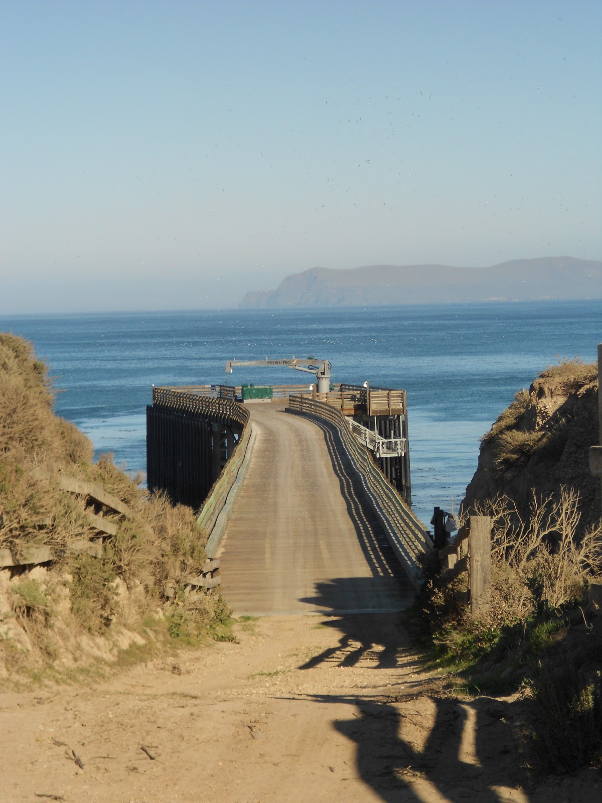
After putting up our tent, Nathan and I decided to explore the cave on our first day. Bear Gulch Cave Trail is just about 2 mile round-trip. We brought flashlights because it was really dark in the cave. Some portions of the cave were closed to protect some bat species. We didn't spend much time because it was getting dark and cold, and we needed to return to our campsite for dinner.


The February night at the Pinnacles was super cold. It was 40 degrees when we were there. Lucky that I found a portable heater at Walmart to keep us warm at night. It worked really well, and a bottle of propane would last about 12 hours!


The next morning we didn't start until late, and the parking lots in the park were all full, so we had to take the shuttle instead to go in the park. The first trail we approached was Condor Gulch Trail (1.7 miles). It was a nice and beautiful trail in spite of the cloudy day.


The weather wasn't great that day because it was cloudy and windy, and the sun only shined occasionally. We had to dress in layers because it could get hot and cold in the same day.


We continued on the High Peak Trail (2.8 mile). It was relatively easy at first, but it got more strenuous later when we had to climb the steep rock steps. There were many people coming with nice binoculars to look for condors at the peaks.


It took us quite a long time on the High Peak Trail because of the strenuous steps and the narrows walkways. Once we passed that part, the trail became easier since we walked downhill and there was nothing to climb.

At the end of the High Peaks Trail there is the Rim Trail (0.4 mile). This trail leads to a relaxing lake called Bear Gulch Reservoir. Nathan and I stopped here for a while to have a snack and enjoy the cool breeze from the water. There were a lot of people with small kids hanging around here. I assumed that they just did the Bear Gulch Cave Trail and took a break before returning to the trail head. I couldn't imagine those people with small kids doing the long, strenuous loop trails like Nathan and I did.

We didn't rest too long and continued on the Bear Gulch Cave Trail (0.7 mile) and Moses Spring Trail (0.5 mile). We were already here the day before, so we didn't take much time to explore the cave this time.


Nathan and I accomplished our second day with a total of 6.1 miles hiking. We didn't get to the campsite until it was already dark. It was also freezing cold after the sunset, so I made boiled rice to help warm us up. The night sky here was gorgeous, and we saw millions of stars, the Milky Way, and even satellites moving across the sky! Too bad it was too cold to stay outside, so Nathan and I just jumped into our cozy tent early every night.


On our third day we decided to do a bigger loop and complete the entire park. We started early at the Old Pinnacles Trailhead (1 mile) and continued on the High Peak Trail (2.6 mile). The trails were easy to follow, but a little boring for the first 2 miles.


When we stopped for lunch, a little bird called Western Scrub-Jay joined our picnic. This bird is well known for steeling the eggs of the red-tailed hawk.

Our goal today was to go to the Balconies Cave. We could see the Balconies clearly from the High Peak trail. Luckily it was a clear day today when we wanted to do a longer hike.


The Tunnel Trail (0.6 mile) is the prettiest trail for me. The scenery is more interesting, with tall rocks and green forest. The trail is a little steep, but that didn't bother us because we were walking downhill. Those people who come to the park through the west entrance will have to walk up this steep trail.


 |
| The Tunnel at the end of Tunnel Trail. |

 Continuing from the Tunnel Trail is the Juniper Canyon Trail (1.2 miles). It's also a beautiful trail leading down to the Chaparal Ranger Station. There are a clean restroom and a nice picnic area there.


Nathan and I didn't take a long rest at the Chaparal Ranger Station because we still had a long way to go. After a short break to the restroom, we immediately walked on the Balconies Caves Trail (0.6 mile) to accomplish our goal of the day.


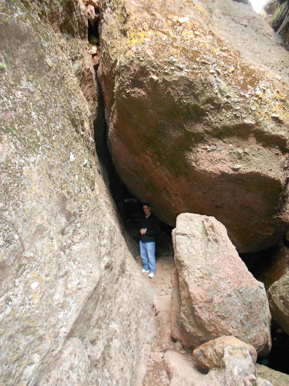
The Balconies Cave is very dark and steep to walk through. It's also wet in most of the cave, so you will need a good flashlight and be more careful climbing on the slippery rocks.

After walking through the cave, we ended up at the other side of the cave, which becomes the Old Pinnacles Trail (3 mile). This trail is pretty flat and easy to follow, but I still had a difficult time getting through it because my feet were sore from the whole day of walking.


On our third day, we accomplished about 9 miles of hiking. Both of my legs and feet were so sore that we didn't feel like hanging outside tonight. It was raining that night, and I slept like a log....
 |